









Todas las subastas / Libros, mapas, papel & manuscritos / World map - Mercator's Projection; La Haye / P

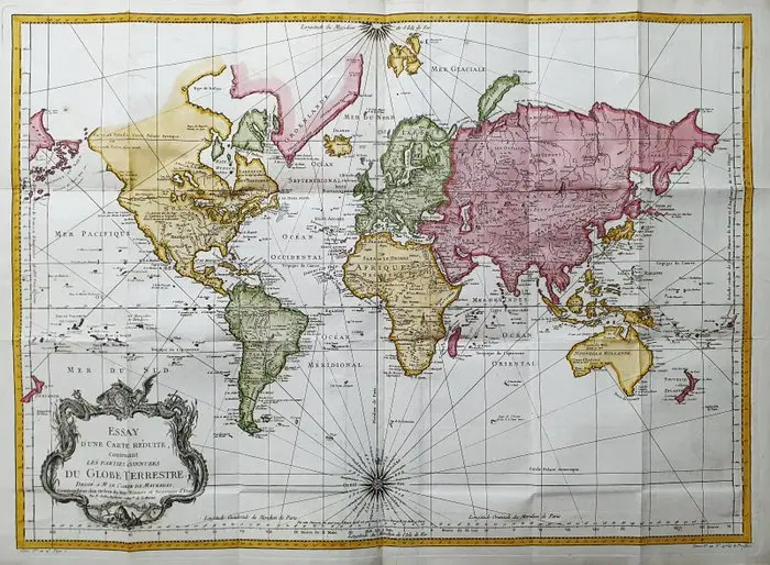
- This Geographical Map is an original copper engraving from 1747 (18th Century). - This is the new and updated edition of BELLIN & PREVOST, edited in 1747 and circa 1788 in their work, which bears the title: "HISTOIRE GENERALE DES VOYAGES AMSTERDAM, 1747". - Beautiful Geographical Map, published in the Netherlands, with excellent inking and fantastic watercolor work, and considering the year of edition, it is geographically well detailed in every point. - Conditions: the conditions are very good, as shown in the photos, with the presence of the usual original editorial folds, entirely insignificant. The overall measurements of the map are: 75 cm x 55 cm.
Estimación:€400
Ir a la subastaVer todos los artículos deCatawikioLibros, mapas, papel & manuscritos
Estimación:
€400

CHRISTIAN DIDRIK FORSSELL. "Carolus XIV Johannes, Rex Sveciae & Norwegiae"
10/27/2026
€81.45
Est.: €179.8


"Great Danish Designers". Published by Lindhardt & Ringhof, 2008.
10/27/2026

€133.8
Est.: €267.54

Dea Trier Mørch: "En trekant", Portfolio of 12 linocuts, 1977. Signed
10/27/2026
€294.36
Est.: €535.12
¡Lleva tu subasta a coleccionistas de todo el mundo!
Publica ahoraAl suscribirte, aceptas la política de privacidad. Cancela tu suscripción en cualquier momento.
Barnebys HQ
Brahegatan 10
BOX 5038
114 37 Stockholm
