
Todas las subastas / Libros, mapas, papel & manuscritos / Italy - Italy; Matthäus Seutter (1678–1757) - Nova Totius...

Italy - Italy; Matthäus Seutter (1678–1757) - Nova Totius...
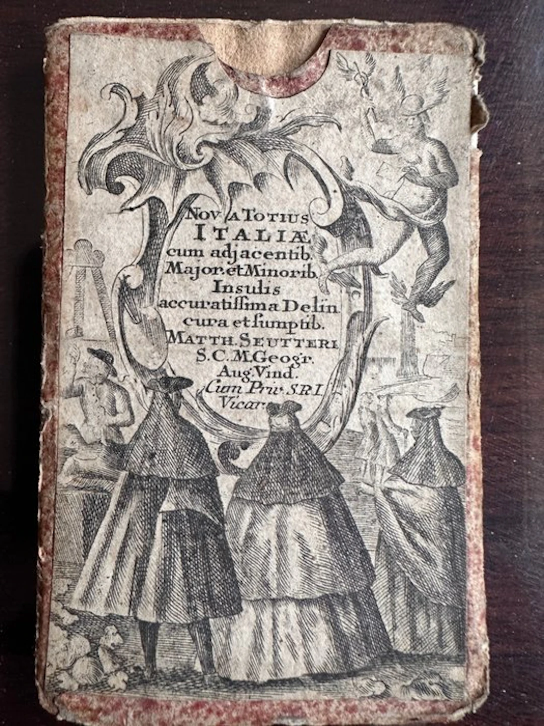
Matthäus Seutter – Nova Totius Italiae – 1744 – Hand-Coloured Map of Italy with Contemporary Case Description Matthäus Seutter (1678–1757) Nova totius Italiae cum adjacentibus Majoribus et Minoribus Insulis accuratissima Delineatio. Augsburg, 1744. A decorative and historically significant 18th-century map of Italy, engraved on copper and hand-coloured at the time, by the famous German cartographer Matthäus Seutter. This is the small-format edition of Seutter’s famous map of Italy, published in Augsburg in 1744 in the Atlas minor praecipua orbis terrarum. The map is documented in international cartographic collections at approximately 20 × 26 cm. Despite its compact size, the map is extremely detailed, depicting the entire Italian peninsula as well as Sicily, Sardinia, Corsica and the surrounding areas, with numerous place names, towns, rivers, lakes, mountains and territorial boundaries. The map is particularly noteworthy for its lavish Baroque allegorical title cartouche, compass rose and distance scales. A particularly interesting feature of the present copy is the contemporary decorated paper case/cover, which itself bears an engraved decorative composition incorporating the title and figures. Contemporary covers of this type are documented for pocket maps from Seutter/Lotter’s Atlas minor. Map size: approximately 20 × 25.5 cm. Technique Copper engraving with contemporary hand colouring on laid paper. Date 1744 Place of publication Augsburg, Germany. Condition The map is in good condition considering its age, with the original folds associated with its intended pocket/atlas format. Some normal signs of handling and ageing are present. The contemporary paper case/cover shows abrasions, staining and signs of use consistent with its age, while retaining its characteristic engraved decoration. The photographs form an integral part of the condition description. ⸻ Matthäus Seutter – Nova Totius Italiae – 1744 – Handkolorierte Italienkarte mit zeitgenössischer Schutzhülle Description Matthäus Seutter (1678–1757) Nova totius Italiae cum adjacentibus Majoribus et Minoribus Insulis accuratissima Delineatio. Augsburg, 1744. An ornamental and historically significant 18th-century map of Italy, engraved on copper and contemporarily hand-coloured, by the renowned German cartographer Matthäus Seutter. This is the small-format edition of Seutter’s famous Italian map, published in Augsburg in 1744 in the Atlas minor praecipua orbis terrarum. The map is documented in international cartographic collections at approximately 20 × 26 cm. Despite its small format, the map is extremely detailed and shows the entire Italian peninsula as well as Sicily, Sardinia, Corsica and the neighboring areas, with numerous place names, cities, rivers, lakes, mountains and territorial boundaries. Particularly attractive are the elaborately designed allegorical Baroque cartouche, the wind rose and the distance scales. The present copy is offered together with a contemporaneous decorated paper sleeve or folder, which also features an engraved decorative composition including the title and figures. Contemporary sleeves of this type are documented for Seutter/Lotter’s Atlas minor pocket maps. Cartographic size: approx. 20 × 25.5 cm. Technique Copper engraving with contemporary hand colouring on laid paper. Year 1744 Place of publication Augsburg, Germany. Condition The map is in good condition considering its age, with the original folds typical for use as a pocket/atlas map. The contemporaneous paper sleeve shows signs of wear, stains and use consistent with age, while the engraved decoration is preserved. The photographs are an integral part of the condition description. ⸻ Matthäus Seutter – Nova Totius Italiae – 1744 – Carte de l’Italie coloriée à la main avec étui d’époque Description Matthäus Seutter (1678–1757) Nova totius Italiae cum adjacentibus Majoribus et Minoribus Insulis accuratissima Delineatio. Augsbourg, 1744. Beautiful 18th-century geographical map of Italy, copper-engraved and hand-coloured at the time, by the famous German cartographer Matthäus Seutter. This is the small-format version of Seutter’s famous map of Italy, published in Augsburg in 1744 in the Atlas minor praecipua orbis terrarum. This map is documented in international cartographic collections with dimensions of about 20 × 26 cm. Despite its reduced size, it is extremely detailed and represents the entire Italian peninsula, as well as Sicily, Sardinia, Corsica and the surrounding territories, with numerous place names, towns, rivers, lakes, mountains and territorial divisions. The map is particularly remarkable for its large Baroque allegorical cartouche with the title, as well as the wind rose and distance scales. The exemplar is kept with a contemporaneous decorated paper sleeve, also adorned with an engraved composition including the title and figures. Contemporary sleeves of this type are documented for Seutter/Lotter’s Atlas minor pocket maps. Map size: approximately 20 × 25.5 cm. Technique Copper engraving with contemporary hand colouring on laid paper. Date 1744 Place of publication Augsburg, Germany. State Good overall condition considering its age, with the original folds typical for a pocket/atlas map. The contemporaneous paper sleeve shows abrasions, stains and signs of wear consistent with use and age, but the engraved decoration remains. The photographs form an integral part of the condition description. ⸻ Titolo Matthäus Seutter – Nova Totius Italiae – 1744 – Carta dell’Italia colorata a mano con custodia coeva Descrizione Matthäus Seutter (1678–1757) Nova totius Italiae cum adjacentibus Majoribus et Minoribus Insulis accuratissima Delineatio. Augsburg, 1744. Rara e raffinata carta geografica dell’Italy del XVIII secolo, incisa in rame e colorata a mano all’epoca, realizzata dal celebre cartografo tedesco Matthäus Seutter. Si tratta della riduzione in formato tascabile della grande carta dell’Italia di Seutter, pubblicata nell’Atlas minor praecipua orbis terrarum ad Augsburg nel 1744. L’esemplare è documentato in collezioni cartografiche internazionali con dimensioni di circa 20 × 26 cm. Nonostante le dimensioni contenute, la carta è ricchissima di informazioni: raffigura l’intera penisola italiana, Sicilia, Sardegna, Corsica e i territori circostanti, con numerosi toponimi, città, fiumi, laghi, rilievi e suddivisioni territoriali. Particolarmente pregevole è il grande cartiglio allegorico barocco con il titolo, oltre alla rosa dei venti e alle scale delle distanze. L’esemplare è conservato nella sua custodia/cartella coeva in carta decorata, anch’essa impreziosita da una composizione incisa con figure e dal titolo della carta. Questo tipo di custodia è documentato per le carte tascabili dell’Atlas minor di Seutter/Lotter. Dimensioni della carta: circa 20 × 25,5 cm. Tecnica Incisione in rame con coloritura coeva a mano, su carta vergata. Data 1744 Luogo Augsburg, Germania. Condizioni La carta presenta buone condizioni generali in rapporto all’età, con le pieghe originali dovute alla sua destinazione come carta tascabile/da atlante. Sono presenti normali segni di manipolazione e invecchiamento. La custodia/cartella coeva presenta abrasioni, macchie e usura compatibili con l’uso e con l’età, ma conserva integralmente la sua caratteristica decorazione incisa. Le fotografie costituiscono parte integrante della descrizione del stato di conservazione. ⸻ Carte de l’Italie coloriée à la main avec étui d’époque Description Matthäus Seutter (1678–1757) Nova totius Italiae cum adjacentibus Majoribus et Minoribus Insulis accuratissima Delineatio. Augsburg, 1744. Rare et raffinée carte géographique de l’Italie du XVIIIe siècle, gravée sur cuivre et coloriée à la main à l’époque, réalisée par le célèbre cartographe allemand Matthäus Seutter. Il s’agit de la version de petit format de la célèbre carte de l’Italie de Seutter, publiée à Augsbourg en 1744 dans l’Atlas minor praecipua orbis terrarum. Cette carte est documentée dans des collections cartographiques internationales avec des dimensions d’environ 20 × 26 cm. Malgré son format réduit, elle est extrêmement détaillée et représente toute la péninsule italienne, ainsi que la Sicile, la Sardaigne, la Corse et les territoires voisins, avec de nombreux noms de lieux, villes, rivières, lacs, montagnes et divisions territoriales. La carte est particulièrement remarquable par sa grande cartouche allégorique baroque, sa rose des vents et ses échelles de distance. L’exemplaire est conservé avec une housse ou chemise contemporaine en papier décoré, elle-même ornée d’une composition gravée comprenant le titre et des figures. Des housses contemporaines de ce type sont documentées pour les cartes de poche de l’Atlas minor de Seutter/Lotter. Dimensions de la carte : environ 20 × 25,5 cm. Technique Gravure sur cuivre avec mise en couleurs à la main sur papier vergé. Date 1744 Lieu d’impression Augsbourg, Allemagne. État Bon état général compte tenu de l’âge, avec les plis d’origine liés à son utilisation comme carte tascabile/da atlante. La housse contemporaine en papier présente abrasions, taches et signes d’usure liés à l’âge et à l’utilisation, tout en conservant sa décoration gravée. Les photographies font partie intégrante de la description de l’état de conservation. ⸻
Estimación:€200
Ir a la subastaVer todos los artículos deCatawikioLibros, mapas, papel & manuscritos
Estimación:
€200
Artículos similares





Resultados de subastas para artículos similares
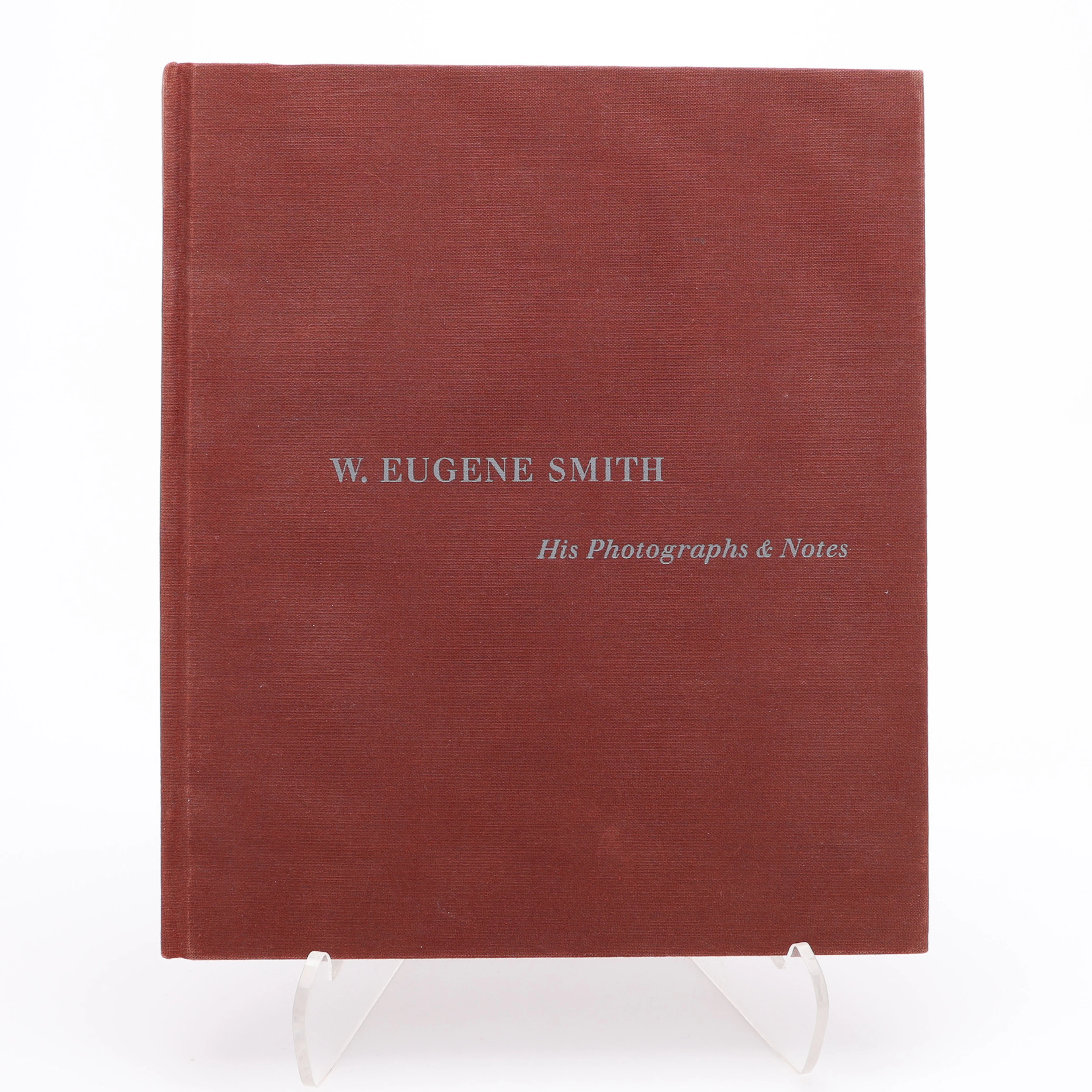
W. EUGENE SMITHS APERTUREMONOGRAFI "W. EUENE SMITH: HIS PHOTOGRAPHS
10/08/2026
€26.77
Est.: €30.96
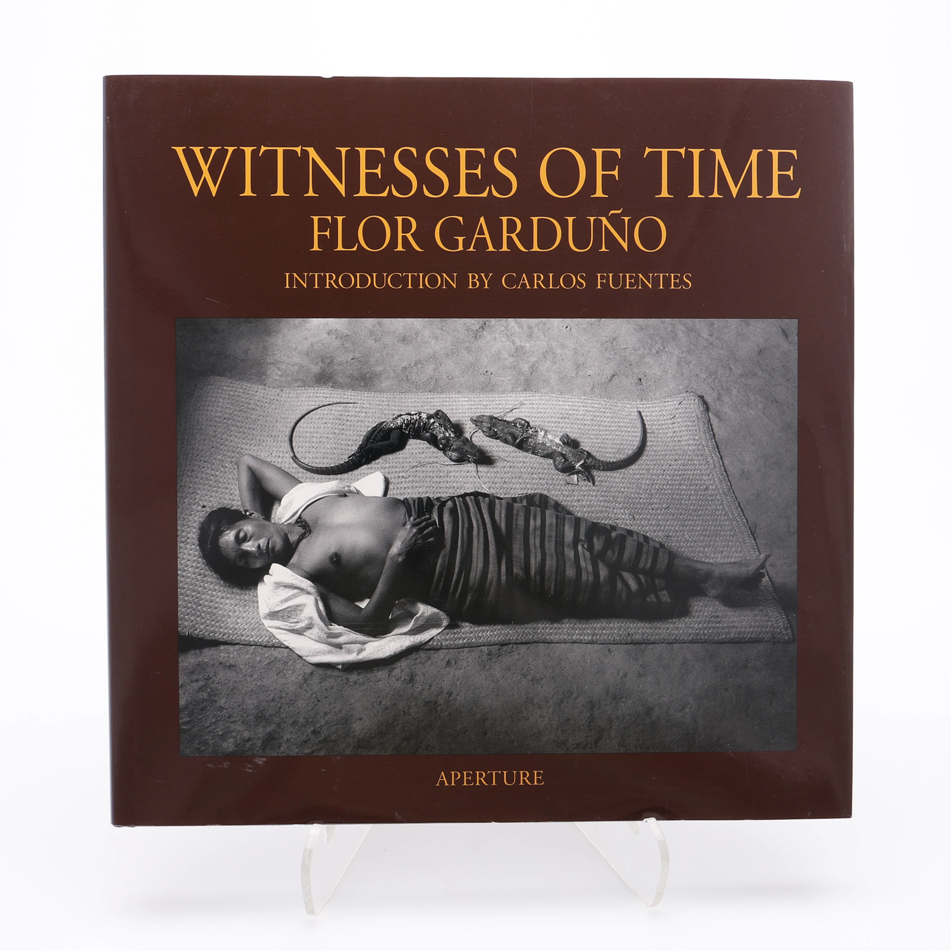
FLOR GARDUÑOS APERTURE-MONOGRAFI "WITNESS OF TIME", 2000.
10/08/2026
€26.77
Est.: €35.71

PAULO NOZOLINOS UTSTÄLLNINGSBOK "FAR CRY", 2005.
10/08/2026
€26.77
Est.: €31.25
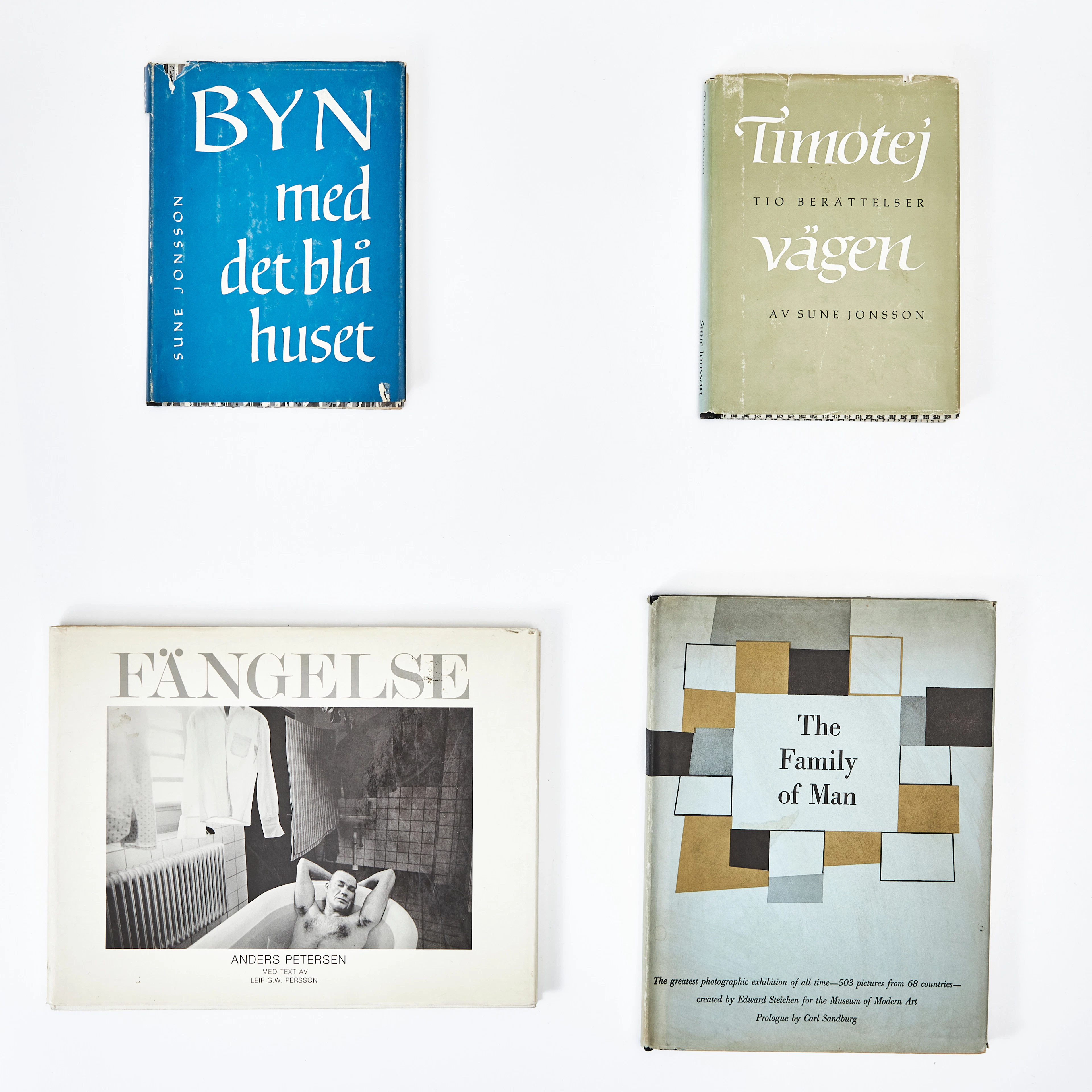
FOTOBÖCKER, 4 st, varav två av Sune Jonsson, samt "The Family of Man"
10/08/2026
€60.24
Est.: €89.28
¡Lleva tu subasta a coleccionistas de todo el mundo!
Publica ahora