









Todas las subastas / Libros, mapas, papel & manuscritos / France - Lower Alsace: the Bas-Rhin

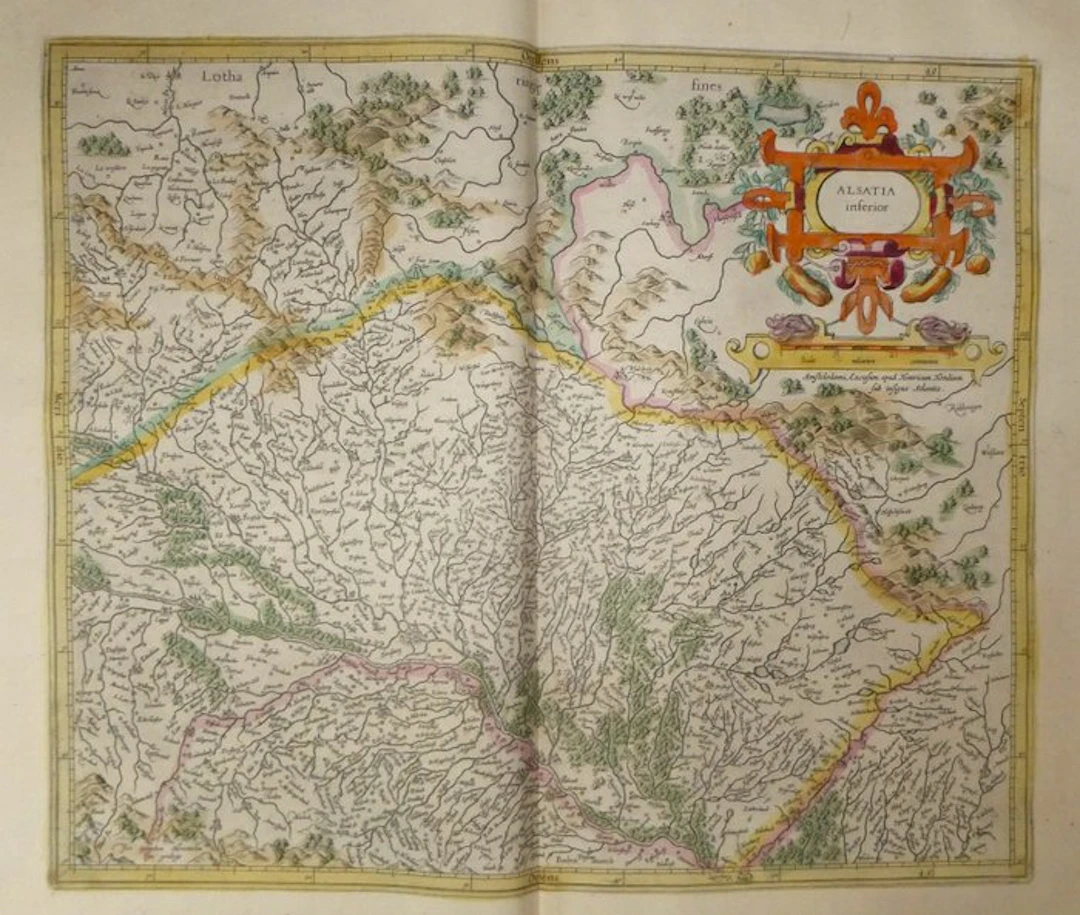
Ancient copper engraving on copper of Lower Alsace by Gerard Mercator, published in 1633 in the Mercator-Hondius atlas. The plain of Alsace is shown traversed by the Rhine ("Rhenus flu.") and the Ill, with Strasbourg depicted at the edge of the river. The map is oriented with the west at the top, as indicated by the cardinal points in Latin inscribed around the graduated border. The title cartouche, in the upper right, is a frame with scrolls decorative of foliage and fruits, colored in orange, yellow and claret. It sits above the scale ("Scala miliarium communium") and the publisher Henricus Hondius in Amsterdam. The Vosges are drawn as small shaded mounds and the forests as clusters of trees highlighted in green. The territorial boundaries are outlined with yellow, pink and green hatching. Numerous toponyms appear in old spelling, including Schlestatt (Sélestat), Zabern (Saverne), Pfalzburg (Phalsbourg), Sarburg (Sarrebourg), Offenburg and Landau. The inscription "Lotharingiae fines" marks the boundary of Lorraine at the top of the map, and "Baden march" the country of Baden at the bottom. The signature "Per Gerardum Mercatorem cum privilegio" is engraved in the lower-left corner. The verso bears the French text "La Basse Alsace" (pages 457 and 460), with a wood-engraved initial and the list of bishops, princes and free towns of the Rhine circle. - Dimensions: sheet 56 x 47.5 cm; map plate 46.9 x 35.3 cm - Condition: Very good overall for a map of this age. There are traces on the verso not affecting the legibility of the text. See photos for details. Atlas Mercator-Hondius - The atlas called "Mercator-Hondius" revives the work of Gerard Mercator, whose copper plates were purchased by Jodocus Hondius in 1604. This 1633 French edition is signed by his son Henricus Hondius and his son-in-law Joannes Janssonius, who augmented it with new maps. Gerard Mercator – Gerard Mercator (Rupelmonde, 1512 – Duisburg, 1594), a Flemish cartographer, mathematician and engraver, studied at the University of Leuven. Settled in Duisburg in 1552, he published in 1569 the world map drawn according to the projection that bears his name. He devoted the end of his life to a collection of maps titled the “Atlas,” published in parts from 1585 and completed by his son Rumold in 1595. The copper plates were acquired in 1604 by Jodocus Hondius (1563-1612), who reissued and expanded the work in Amsterdam. His son Henricus Hondius (1597-1651), whose address appears on this map, continued its publication.
Estimación:€150
Ir a la subastaVer todos los artículos deCatawikioLibros, mapas, papel & manuscritos
Estimación:
€150
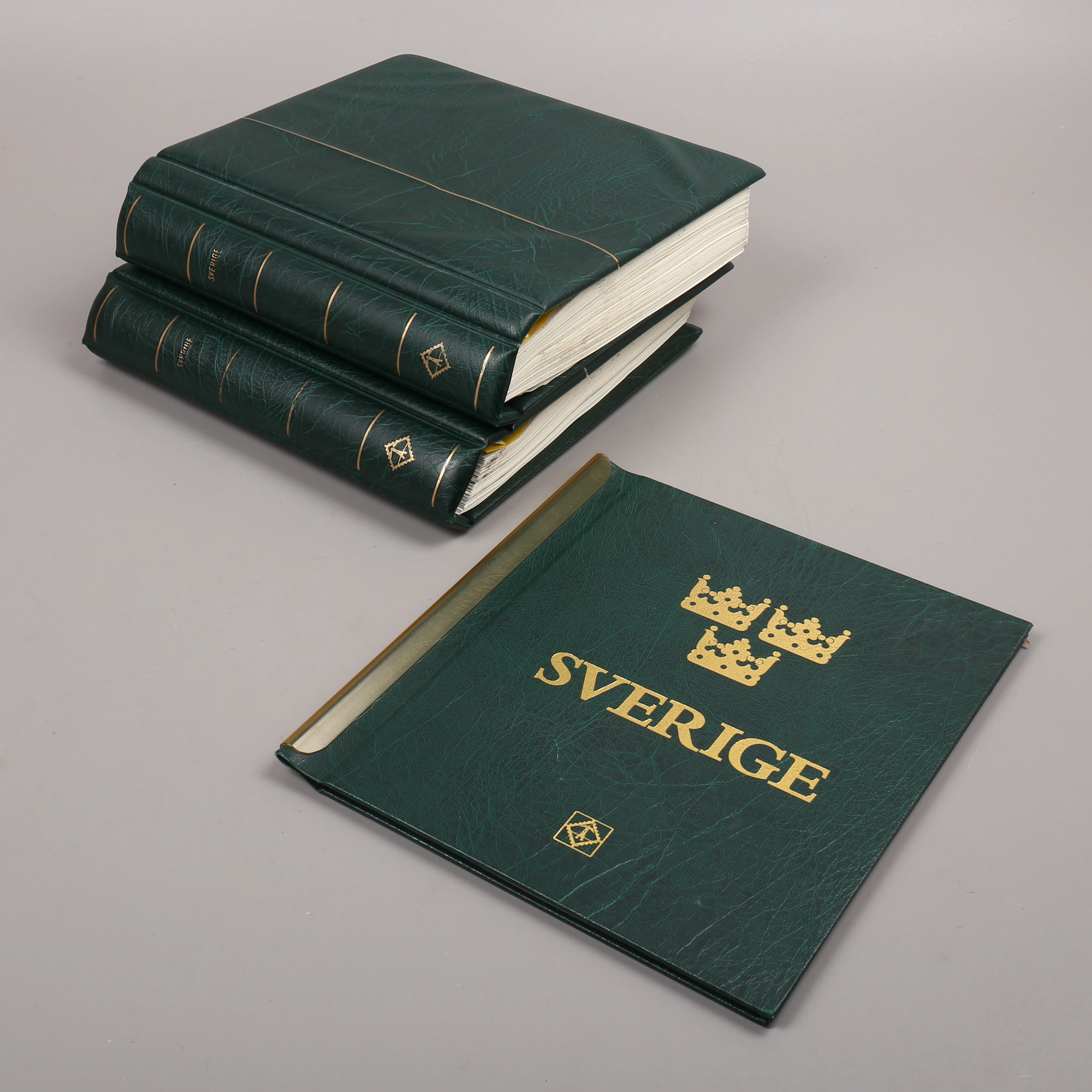
FRIMÄRKSSAMLING, 3 st album, Sverige, 1976-2010.
10/21/2026
€91.29
Est.: €89.88
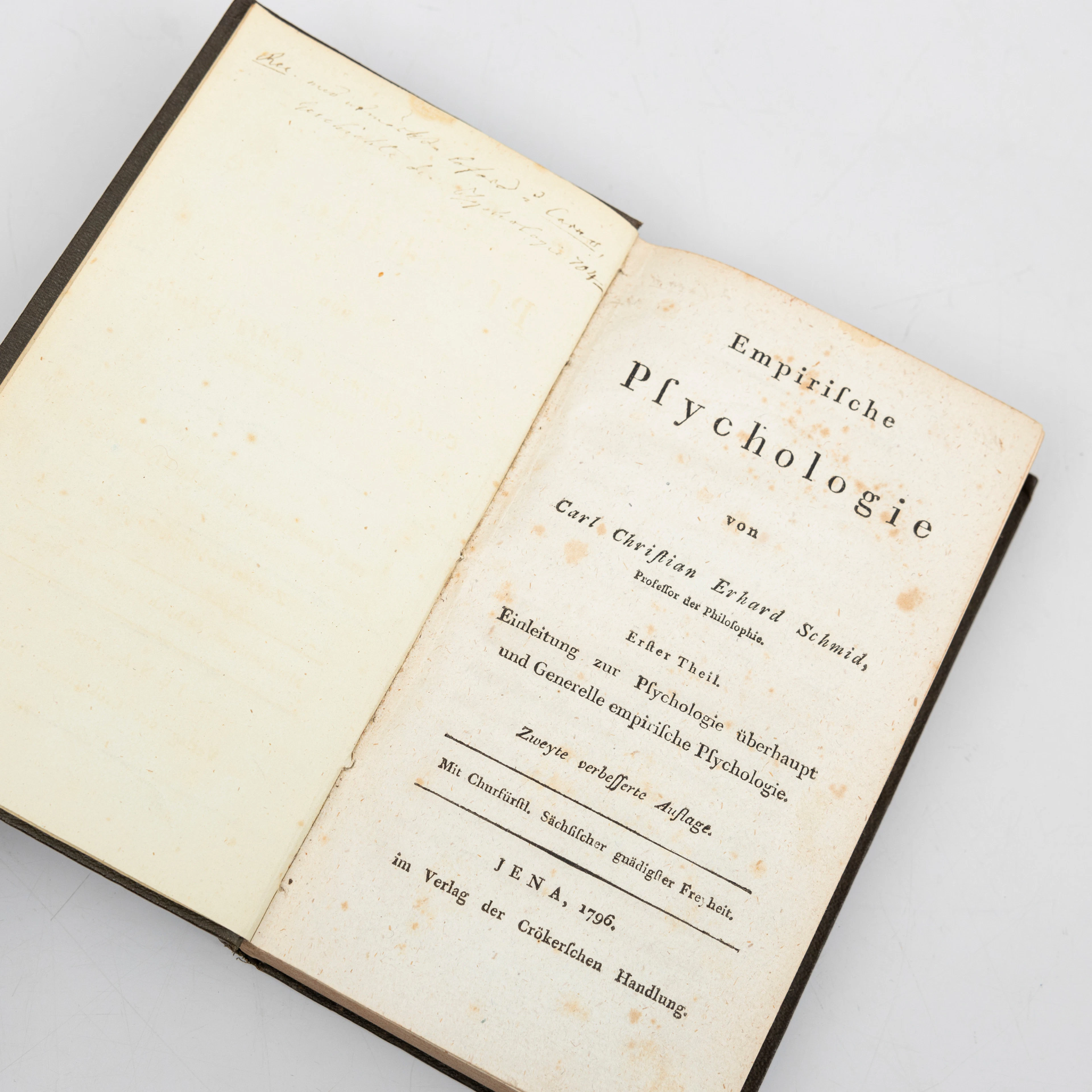
CARL CHRISTIAN ERHARD SCHMID. "Empirische Psychologie“, Erfter Theil
10/21/2026
€44.97
Est.: €134.37
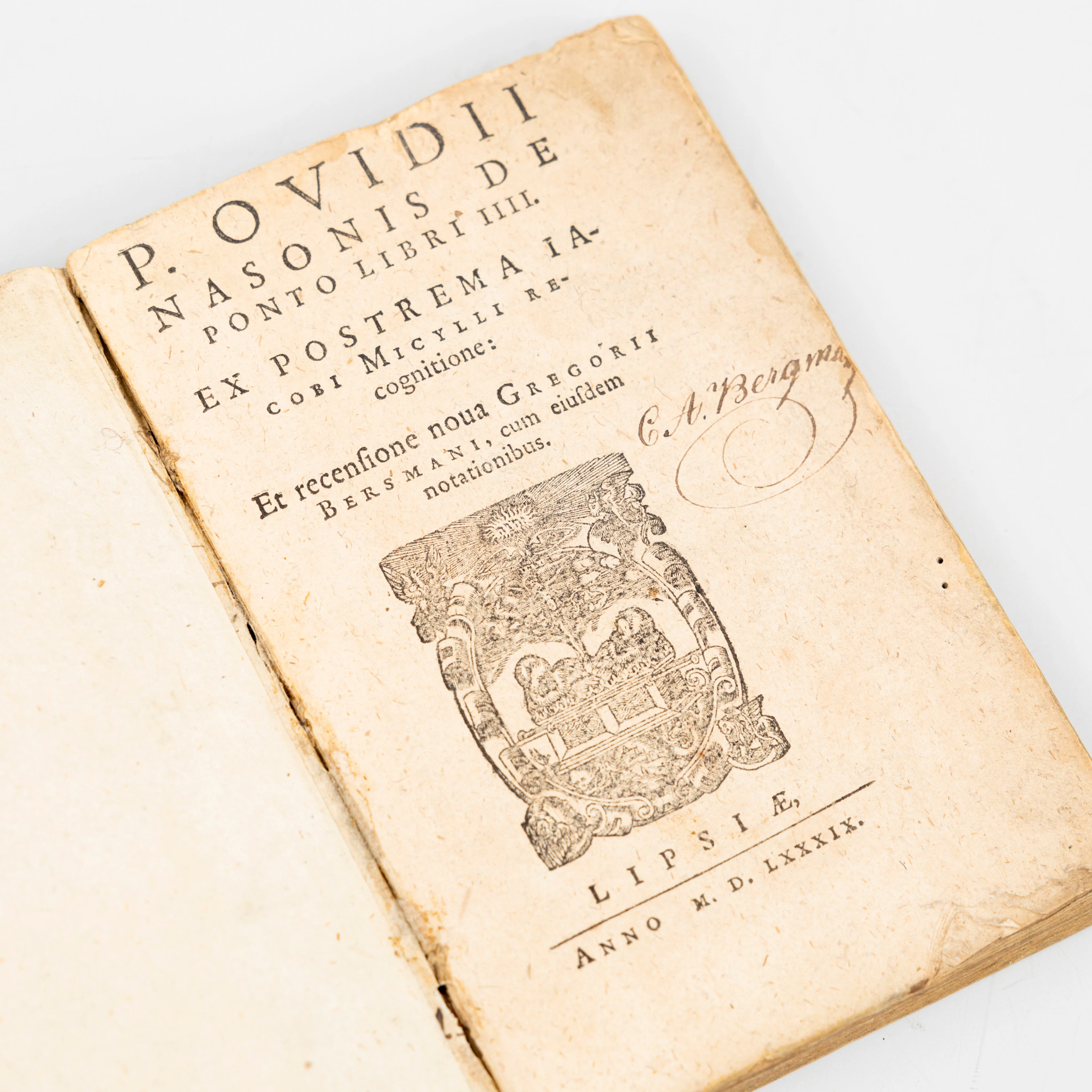
PUBLII OVIDII NASONIS. "De Ponto libri IIII", Ex postrema Iacobi Micylli
10/21/2026
€71.95
Est.: €224.7


OCT 27 | 4:00 PM
¡Lleva tu subasta a coleccionistas de todo el mundo!
Publica ahoraAl suscribirte, aceptas la política de privacidad. Cancela tu suscripción en cualquier momento.
Barnebys HQ
Brahegatan 10
BOX 5038
114 37 Stockholm
